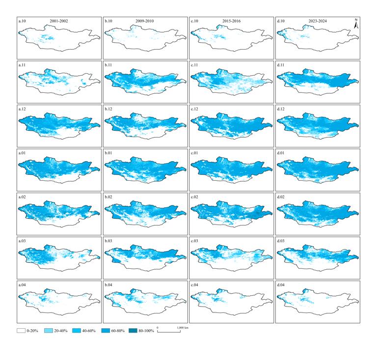
This dataset is the monthly distribution dataset of 500-meter snow cover in Mongolia from 2000 to 2024. This data was obtained from MOD10A1 image data through data preprocessing, model training, and Google Earth Engine deployment predictions. The data format is TIF format with a spatial resolution of 500 m.
Comment list ( 1 )

how do i download this

