Label : droughtMongoliaMongolian Plateau
Date: 2025-06-16
View counts: 3165
Browse document: Browse document
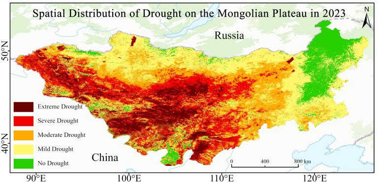
This dataset depicts the spatial distribution of drought conditions across the Mongolian Plateau from 2000 to 2023, with a resolution of 1 km. The data are stored in raster format (.tif), featuring a spatial resolution of 1 km and an annual temporal resolution. This dataset exhibits high spatiotemporal continuity and scalability, making it suitable for various analytical applications.
Comment list ( 0 )

