Label : surface waterMongoliaMongolian Plateau
Date: 2025-02-19
View counts: 1846
Browse document: Browse document
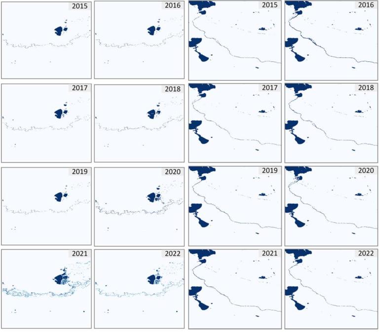
This data set is a 30 meter surface water body distribution data set in Mongolia from 2013 to 2022. It has 10 phases in total. The data is obtained from Landsat 8 image data through data preprocessing, model training and Google Earth Engine deployment prediction. The data format is TIF format, and the spatial resolution is 30 meters.
Comment list ( 0 )

