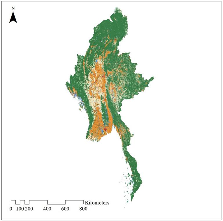
Login   |      Register
English    中文


Land use data for Myanmar (10m)


Land use data for Myanmar (10m)

Label :

Date: 2025-03-31

View counts: 77

Download Dataset: Log in

The spatial resolution of the land use data is 10m. The data comes from ESA's 2021 global land cover classification, which includes mangroves, forests, grasslands, buildings, crops, etc.

Title alternate
Land use data for Myanmar (10m)
Parent identifier
Elementary geography
Topicategory
Elementary geography
Language
English
Type
raster data
Format
tif
Time begin
2021
Time end
2021
Creator
ESA
Publisher
ESA
Contributor
ESA
Organization
IKCEST-DRR
Operateson
IKCEST-DRR
Source
ESA (https://worldcover2021.esa.int/)

    Sign in for comments!

Comment list ( 0 )