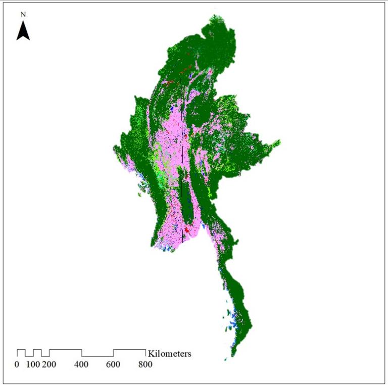
The spatial resolution of the land use dataset is 30m. The data comes from GLC_FCS30. The data uses a granular classification system of 35 land cover categories.
Data format
Raster
Subject
Ocean
Comment list
( 1 )
minthu22081974
2026-07-01 14:17:44
I would like to download the land use data set of myanmar.