Label : Land cover distributionChina-Pakistan Transportation Corridor
Date: 2023-01-10
View counts: 2529
Browse document: Browse document
Download Dataset: Log in
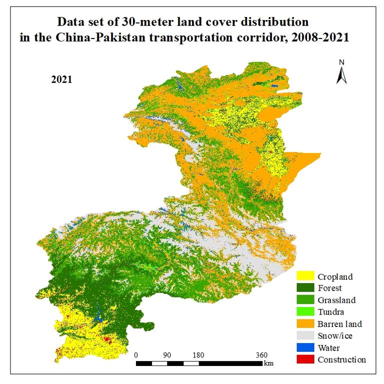
This dataset is a 30-meter land cover distribution dataset for the China-Pakistan transportation corridor from 2008 to 2021, with 14 issues. The data were obtained from Landsat 8/5 image data through data pre-processing, sample selection, feature parameter adjustment, and application of random forest classification method based on Google Earth Engine platform. The data format is TIF format, the spatial resolution is 30 meters, and the overall accuracy of the data reaches more than 85%. This dataset provides the background data for the study of China-Pakistan transportation corridor and can be used as the basis for other studies.
Comment list ( 1 )

cfbfghfgnfghghrth

