Label : Sand stormMongolian PlateauDust indexno threshold methodMODIS
Date: 2025-06-16
View counts: 2256
Browse document: Browse document
Download Dataset: Log in
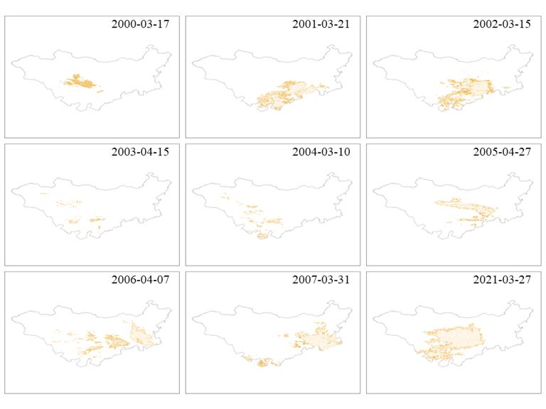
This data set is a 1 km spring sandstorm distribution on the Mongolian Plateau from 2000 to 2021. It has 22 phases in total. The data is obtained from MODIS data through data preprocessing, building sandstorm detection index(DSDI), and extracted the spatial distribution information of dust to obtain the of spring sandstorm distribution. The data format is Shp format, and the spatial resolution is 1 km. This dataset can directly reflect the spatial distribution of sandstorms on the Mongolian Plateau, which can provide detailed and reliable data support for the control of sandstorm disasters, At the same time, it can also back up decision-making process of controlling the risk of sandstorm disasters on the Mongolian Plateau.
Comment list ( 0 )

