AI and GIS are enhancing disaster response capabilities, leading to more efficient operations, reduced costs, and improved communication. These technologies facilitate real-time data analysis, predictive modeling, and multi-agency collaboration. They play a crucial role across various disaster management scenarios, supporting efforts in prediction, impact mitigation, and the protection of critical infrastructure. Overall, AI and GIS are transforming how we prepare for, respond to, and recover from natural disasters, offering significant potential as tools for building resilience in the face of environmental challenges.
Federal agencies are leveraging AI and geospatial information systems (GIS) to aid in natural disaster response. The tech is reducing duplicative spending, breaking down communication siloes and increasing efficiency. California Congressman and Chairman of the Bipartisan Task Force on Artificial Intelligence Jay Obernolte spoke with GovCIO Media & Research during Esri’s Federal GIS Conference last month about how the state is using AI and GIS to perform emergency services to those affected by the wildfires.
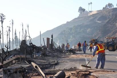
According to National Oceanic and Atmospheric Administration data, the nation has sustained 403 weather and climate disasters since 1980. Overall damages and costs reached or exceeded $1 billion, with a cumulative total cost of these events exceeding $2.915 trillion. According to the state’s Department of Forestry and Fire Protection, California wildfires have burned 57,768 acres of land and destroyed 16,251 structures as of March 10.
The state used GIS to create real-time mapping tools, provide essential support to first responders and inform residents with actionable data. Interactive maps can display fire perimeters, evacuation zones and other critical information. “It uses satellite imagery and AI algorithms to detect which homes were destroyed and which ones weren’t. And if you layer that on top of the LA County assessor’s parcel map, homeowners could actually see exactly what was going on, and that’s a really beneficial use of that technology,” Obernolte added.
Data Systems Help Drive Efficiencies
The National Aeronautics and Space Administration (NASA) and the U.S. Geological Survey (USGS) are using GIS to break down siloes between emergency response efforts during natural disasters.
Hurricane Helene, a catastrophic category four storm last fall caused widespread flooding and damage across Florida, Tennessee, Georgia and North Carolina. A North Carolina Office of State Budget and Management (OSBM) report on the state’s recovery efforts at the end of last year estimated damage and needs of $59.6 billion from the state alone.
NASA’s Disaster Response Coordination System Program Manager Josh Barnes said during the Esri event that his agency was able to avoid duplicative response efforts during the hurricane by leveraging the tech.
USGS National Geospatial Program Emergency Response Coordinator and Geospatial Information Response Team (GIRT) Chair Xan Fredericks said reducing duplications not only saves money, but also could lead to more successful emergency response efforts. Fredericks added that communities impacted by natural disasters have limited resources, and agency collaboration can relieve strain on the communities.
Data Supports Critical Infrastructure Security
Other agencies like the National Nuclear Security Administration (NNSA) are using GIS and automation to secure critical infrastructure and reduce spending. The cloud-based GIS platform ArcGIS Online, for example, enables users to create interactive web maps, analyze data and boost collaboration.
NNSA Geospatial Information Officer and Lead Analyst in the Office of Emergency Management Tonya Jeppesen said real-time and near real-time analytics from ArcGIS Online have enabled watch officers to focus on threats that could impact critical infrastructure. With spatial and predictive modeling, Jeppesen and her team have been able to examine wind data, fire locations and sizes, terrain information and other classification data that helps connect the pieces for protecting nuclear plants.
Sources:
GovCIO Media & Research
https://govciomedia.com/gis-aids-government-in-natural-disaster-response/ .
Provided by the IKCEST Disaster Risk Reduction Knowledge Service System
Comment list ( 0 )

