Label : precipitation abnormity percentageBelt and Road
Date: 2017-10-26
View counts: 11269
Browse document: Browse document
Download Dataset: Log in
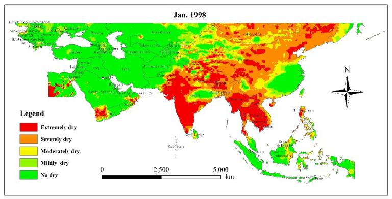
The spatio-temporal distribution of drought information data of countries and regions along the Belt and Road, is an important basis for disaster risk reduction. Based on the Tropical Rainfall Measurement Satellite (TRMM) 3B43 precipitation data, we used the Precipitation Abnormity Percentage drought model to study the monthly spatio-temporal distribution of drought in south region of N50° of OBOR area from 1998 to 2015.
Comment list ( 0 )

