Label : Sand stormDust indexno threshold methodMODIS
Date: 2023-01-09
View counts: 3576
Browse document: Browse document
Download Dataset: Log in
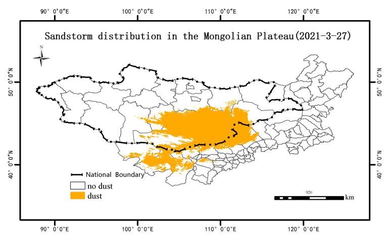
The Mongolian Plateau is one of the cradles of many sandstorms in Asia, among which the Gobi region of Mongolia and the desert region of western Inner Mongolia are closely related to the frequent sandstorm events in China and Mongolia in recent years. Based on this study first text mining data, statistical sandstorm events in the Mongolian plateau in 2000-2021, download MODIS data corresponding space and time area, combined with cloud volume and other data screening, after the MRTK plugin MODIS data geometric correction, build dust index DSDI, extract dust spatial distribution information, get the Mongolian plateau sandstorm distribution data set.Combined with the Arcgis software to randomly select the verification points, combined with the station record, text data, image enhancement, visual interpretation, so as to complete the accuracy evaluation,The overall classification accuracy reached 85.24%, and had a Kappa coefficient of 0.7636. This data set directly reflects the spatial distribution of sandstorms in Mongolian Plateau, which can provide detailed and reliable data support for the control of sandstorm disasters. At the same time, it can also provide decision support for controlling the risk of sandstorm disaster in the Mongolian Plateau.
Comment list ( 0 )

