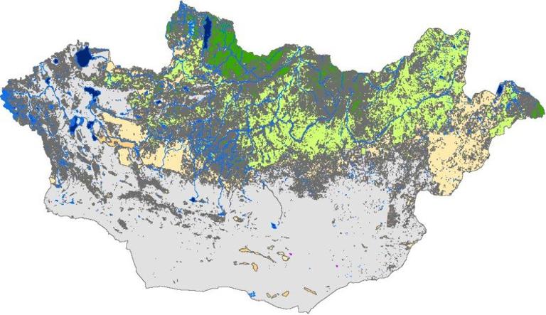
Label : Mongolialand coverLand usevegetation
Date: 2017-08-04
View counts: 12278
Browse document: Browse document
Download Dataset: Log in
This dateset provides land use/cover data of Mongolia, with the spatial resolution of 30m, using the Albers projection, based on WGS-1984 geographic coordinate system. This data was interpreted on the basis of Landsat TM/etm+ remote sensing image and has 9 first classes including forest land, grassland, wet land, cultivated land, water, tundra,construction land, bare land and snow.The classfication accuracy is 82.26% and can be used for the study of land use/cover change in Mongolia, land management, planning and design of urban city.
Comment list ( 2 )

After opening the data on ArcGIS I found out that description of the numbers and the explanations do not match with each other. For example, some noticeably large lakes are marked as tundra region etc. I would appreciate if you could send me a revised version of the data.
I look forward to your response.
wfbvsulbhwsi;vnh

