Release time:2025-01-22
Category: Datasets of March 21, 2024 Naran Avalanche, Pakistan
Label: avalanche
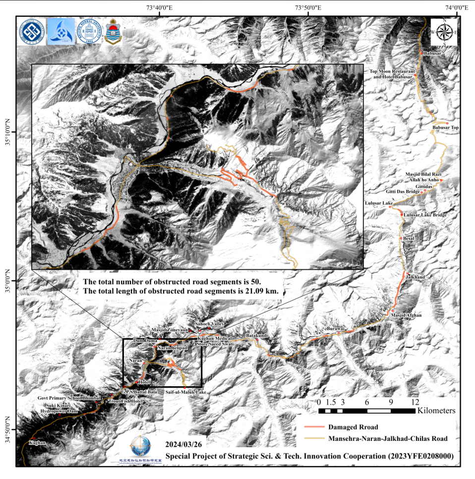
The avalanche incident occurred in Naran, northern Pakistan on March 21, 2024, which submerged houses and hotels, served as a trigger for further in-depth analysis of avalanche risks in the downstream towns and villages. Through comprehensive multi-case studies, it was found that the phenomenon of snow melting into water before heavy precipitation warrants particular vigilance, as it greatly increases the likelihood of avalanches. The spatial-temporal distribution of daily total precipitation was obtained by analyzing data from the Global Precipitation Measurement (GPM) for each day, facilitating an analysis of daily precipitation variations in the region. Subsequently, the Knowledge-Driven Flood Intelligent Monitoring (KDFIM) algorithm, combined with the free accessible Sentinel-1 and Sentinel-2 images of Copernicus Programme, was utilized to infer areas where snow melting into water on ground or slope surface, enabling the identification of early warning signs of snow melting before avalanches. Finally, GF-1B imagery, obtained on March 23 with 2m spatial resolution, from the Land Satellite Remote Sensing Application Center, Ministry of Natural Resources of China, was utilized to analyze the avalanches and assess potential avalanche risks nearby Naran town.

