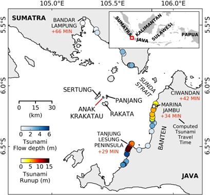
The 22 December 2018 Anak Krakatau volcanic flank collapse triggered a devastating tsunami along the Sunda Strait, highlighting the need for an early warning system to detect both volcanic collapse and landslide-triggered tsunami from seismic data. Seismically, massive landslides exhibit a deficiency in high-frequency radiation compared to tectonic earthquakes, classifying them as long-period events. In order to use seismic signals for tsunami early warning, the analysis must rely heavily on stations at close distances, particularly because slower-traveling surface waves are required for a good location. In this study, we used spectral analysis to distinguish the 2018 flank collapse from typical tectonic earthquakes and utilized long-period back-projection (40–70 s) of surface wave envelopes to assess its location.
Using the Indonesian seismic network, we conducted spectral analysis of the first 100 s of seismic data, with recordings from epicentral distances of 1.0°-2.5°. We confirmed a systematic deficiency of high frequencies in landslide events, enabling the use of a simple frequency ratio to discriminate between earthquakes and landslides. The location was then determined through back-projection within 3 minutes after the event initiation. Our results indicate that the Indonesian seismic network is viable for back-projection, with expected response times within 3–4 minutes at volcanoes with high tsunami potential due to subaerial flank collapse. We conclude by considering practicalities of implementing this approach in operational tsunami early warning systems.
This work set out to test whether the existing broadband network in Indonesia could deliver the speed and reliability needed to warn for landslide-generated tsunamis–a capability that was lacking during the 22 December 2018 Anak Krakatau disaster. The study showed that long-period back-projection, coupled with a simple spectral-ratio classifier, can locate a large flank collapse within three minutes and reliably distinguish it from ordinary earthquakes. Hence, we now know that much of the required early-warning infrastructure is already in place; the remaining challenges lie in optimizing station geometry for the few under-monitored volcanoes, reducing false-positive rates, and fusing seismic detections with other real-time data streams. Our main findings are as follows:
We located the 22 December 2018 flank collapse of Anak Krakatau through long-period back-projection (40–70 s) of surface wave envelopes. By systematically scanning the Indonesian coastline, we located the flank collapse within 3 min after its initiation.
Spectral analysis of the first 100 s of unprocessed vertical component broadband–using stations 1.0°-2.5° from the source showed that a single spectral ratio is sufficient to discriminate landslides from tectonic events. False positives do increase at larger source-station distances, but not monotonically.
An operational workflow would therefore run continuous back-projection to flag long-period sources, apply the spectral-ratio test to separate earthquakes from landslides, and issue alerts weighted for each potentially tsunamigenic volcano. Expanding the PSD library with well-documented earthquakes and confirmed landslides will sharpen the development of decision criteria, possibly going beyond the use of a singular threshold and further reduce false alarms. In addition, any future long-period detection should be treated as a high-priority screening event: it will automatically alert analysts but must still undergo additional checks before any public warning is issued; at this stage, it should be considered a review alert rather than a direct alarm.
Linking detections and locations to potentially tsunamigenic volcanoes adds an immediate risk context. Anak Krakatau, for example, had a hazard score of 76 points before the collapse, making it the most hazardous volcano in Indonesia for tsunami generation prior to the event (67 points afterward; Zorn et al. 2022). Any future long-period alert there should trigger priority scrutiny.
Preliminary tests suggest that the broadband network in Indonesia can already detect and locate major landslides; however, adding near-source stations–particularly in eastern Indonesia–could reduce warning times in that region to well below the three-minute target.
Sources:
Natural Hazards
https://link.springer.com/article/10.1007/s11069-025-07465-z .
Provided by the IKCEST Disaster Risk Reduction Knowledge Service System
Comment list ( 0 )

