Welcome to the IKCEST
Login
|
Register
English
中文
Search
Advanced search
Navigation
Home
Document
Post
Reports
Newsletters
Data
Subject database for earthquake
Subject database for drought
Subject database for flood
Subject database for frozen
Subject database for heat wave
Subject database for wild fire
Subject database for ecology & environment
Subject database for urban
Subject database for social media mining
Subject database for hurricane disaster
Regional basic database for the Belt and Road
Regional disaster database for the Belt and Road
Regional database for China-Mongolia-Russia Economic Corridor
Regional database for China-Pakistan Economic Corridor
Regional database for Bangladesh-China-India-Myanmar Economic Corridor
Maps
China Historical Disaster
Biological Disasters
Geological Disasters
Earthquake Disasters
Meteorologic Disasters
Flood Disasters
Raster Data
Vector Data
Education
Tutorial for GIS
Disaster Knowledge
Presentation
Training Video
Reference report
Disaster news Video
Science Popularization
International Training
Subject-Catalogue
Organization
Experts
Website
Application
Information Aggregation
Application Using Web GIS
Scientific Data Visulization
Natural Science Research Work
Emergency Disaster Mitigation Services
Directory
Scholar
ALL
Earthquake
Flood
Drought
Geological disaster
Forest fire
Tsunami
Extreme heat wave
Typhoon
Disaster warning
Disaster risk reduction
Sichuan-Tibet Railway
Home
Document
News and Events
Publish Document Data
News and Events
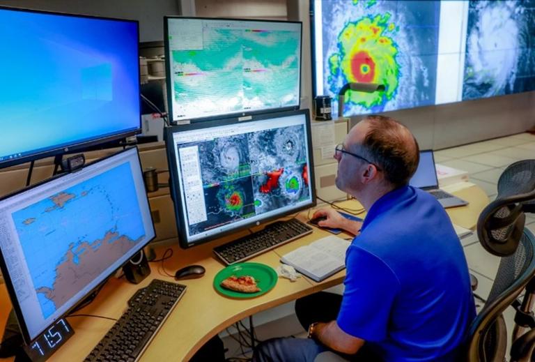
Artificial intelligence can be used to predict river discharge and warn of potential flooding, new Concordia study shows
Artificial intelligence
potential flooding
2024-11-29
Abstract As recent flooding in Spain and elsewhere revealed, every minute of warning given to people ahead of a possible flood ca...
The 8th International Workshop on Disaster Risk Reduction Knowledge Service Successfully Held
Workshop
Disaster Risk Reduction
2024-11-26
Abstract The 8th International Workshop on Disaster Risk Reduction Knowledge Service & The 2nd International Symposium on Geo-Haz...
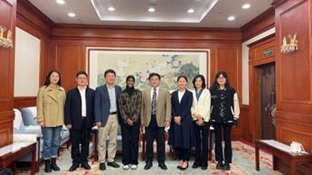
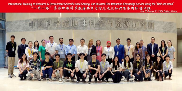
IKCEST Disaster Risk Reduction Team Successfully Held an International Training Workshop
Disaster Risk Reduction
Workshop
2024-11-19
Abstract The International Training Workshop on Resource & Environment Scientific Data Sharing along the“Belt and Road”successful...
Representative from IKCEST participated in the International Symposium of The Category 2 Institutes and Centres under The Auspices of UNESCO in The Field of Natural Sciences
International Symposium
Disaster Risk Reduction
2024-11-12
Abstract The International Symposium of The Category 2 Institutes and Centres (C2C) under The Auspices of UNESCO in The Field of ...
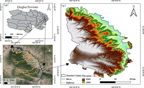
Identification of potential landslide in Jianzha county based on InSAR and deep learning
landslide
climate change
2024-10-31
Abstract Landslide disasters have characteristics of frequent occurrence, widespread impact, and high destructiveness, posing seri...
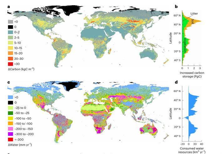
Carbon restoration potential on global land under water resource constraints
Carbon restoration potential
global land under water
2024-10-31
Abstract Ecosystem restoration is a critical nature-based solution to mitigate climate change. However, the carbon sequestration ...
Enhancing Disaster Risk Management through AI – DRM Workshop
resilience enhancement
AI integration
Disaster Risk Management
EU initiatives
capacity building
2024-10-31
Abstract On 22 October 2024, the European Commission's Directorate-General for European Civil Protection and Humanitarian Aid Oper...
El Niño fingered as likely culprit in record 2023 temperatures
Shifting Waters of the Pacific Ocean
Temperature Jump
El Niño
Climate Change
2024-10-31
Abstract Research suggests swings in Pacific Ocean can account for planet’s sudden and perplexing temperature jump. For the past ...
AI to the rescue: how to enhance disaster early warnings with tech tools
AI
early-warning
natural hazards
atmospheric friction
2024-10-31
Abstract Artificial intelligence can help to reduce the impacts of natural hazards, but robust international standards are needed...
Satellite methods provides drought detection from space
Satellite methods
drought detection
space
2024-10-31
Abstract Observing sites like the Amazon basin from space has underscored the capability of satellites to better detect signs of ...
Home
Previous page
3
4
5
6
7
8
9
10
11
12
Next page
End
Go to
page
Jump
Most concern
ISTIC Governing Board Chairman visited IKCEST
DRR reported to the 1st session of the second governing board and advisory committee of IKCEST
IKCEST team attended the Forum on Artificial Intelligence in Africa
Historical earthquake data for China
The picture of Jiuzhaigou earthquake
Recent articles
The 3rd International Symposium on Geo-Hazards Perception, Cognition and Prediction Held in China
Evaluation of flood susceptibility through an artificial neural network-based differential evolution optimization algorithms and GIS techniques
Widespread ecological responses and cascading effects of the 2021 western North American heatwave
Climate change leads to an expansion of global drought-sensitive area
The critical role of soil moisture in compound hazards
Classified catalogue
News
Events
Natural Sciences
Humanity
Social Sciences
Technology
Products
Company
Biological
Climatological
Geophysical
Hydrological
Meteorological
Technological
Basic Knowledge
Guard against Knowledge
Scientific Knowledge
Mountain Flood Disaster Rescue
City Waterlogging Disaster Self-help
Typhoon Disaster Self-help
Data List
|
About
|
Contact Us
|
How to use
京ICP备05002838号-31
© 2008 - 2024 IKCEST All rights reserved