Label : geographical national informationnatural resourcespolitics and economyIran
Date: 2017-08-30
View counts: 9395
Browse document: Browse document
Download Dataset: Log in
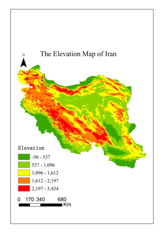
The basic geographical national information data of countries and regions along the Belt and Road, is an important basis for disaster risk reduction. The basic geographical national information dateset of Iran includes three categories, namely, basic national condition, natural resources, politics and economy. The detaial elements in the classification include geographical location, administrative division, topography, soil, climate, rivers and lakes, environment, land resources, water resources, forest resources, animal resources, plant resources, energy resources, mineral resources, non-metallic mineral resources, tourism resources, language, nationality, religion, festivals, political diplomacy, economy, science and technology, education, sports, hospital bed density, etc.
Comment list ( 1 )

this data is very good!

