Login   |      Register
English    中文


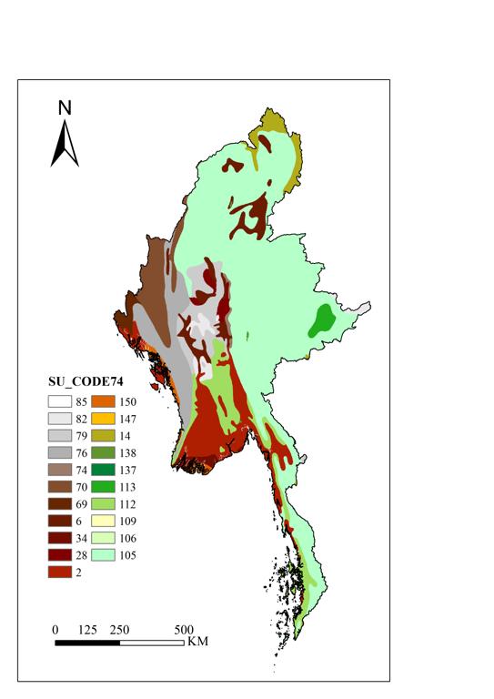
Myanmar soil distribution data


Myanmar soil distribution data

Label :

Date: 2025-03-31

View counts: 96

Download Dataset: Log in

The dataset is available to download in Geotiff format at a resolution of 30 arc-second (approximately 1000m at the equator). It provides information on soil types, soil phases, and soil physico-chemical properties at each grid point (organic Carbon, pH, water storage capacity, soil depth, cation exchange capacity of the soil and the clay fraction, total exchangeable nutrients, lime and gypsum contents, sodium exchange percentage, salinity, textural class and granulometry).

Title alternate
Myanmar soil in 2020
Parent identifier
Geographical Sciences
Topicategory
Geographical Sciences
Language
English
Type
Raster data
Format
TIF
Time begin
2020
Time end
2020
Creator
FAO
Publisher
FAO
Contributor
FAO with IIASA, ISRIC-World Soil Information, Institute of Soil Science, Chinese Academy of Sciences (ISSCAS), and the Joint Research Centre of the European Commission (JRC)
Organization
IKCEST-DRR
Operateson
IKCEST-DRR
Source
FAO(https://www.fao.org/soils-portal/soil-survey/soil-maps-and-databases/harmonized-world-soil-database-v12/en/)

    Sign in for comments!

Comment list ( 0 )