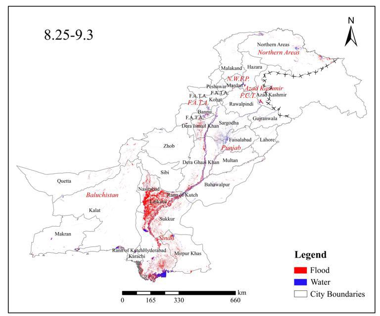
This dataset is the spatial distribution map of floods in Pakistan in 2022. Google Earth engine is used to process sentinel1 data and threshold method is used to extract water body. The data format is tiff, and the spatial resolution is 30m.This dataset is the spatial distribution map of floods in Pakistan in 2022. Google Earth engine is used to process sentinel1 data and threshold method is used to extract water body. The data format is tiff, and the spatial resolution is 30m.
Comment list ( 6 )

Great work!
Very useful dataset , keep the work up .
great to have data on pakistan
I need this gis data and remotes. Thank you so much.
I really need it for my research. Thank you.
gis and remotes

