Label : Spatio-temporal DistributionDesertification DisasterChina-Mongolia railway
Date: 2020-10-28
View counts: 6965
Browse document: Browse document
Download Dataset: Log in
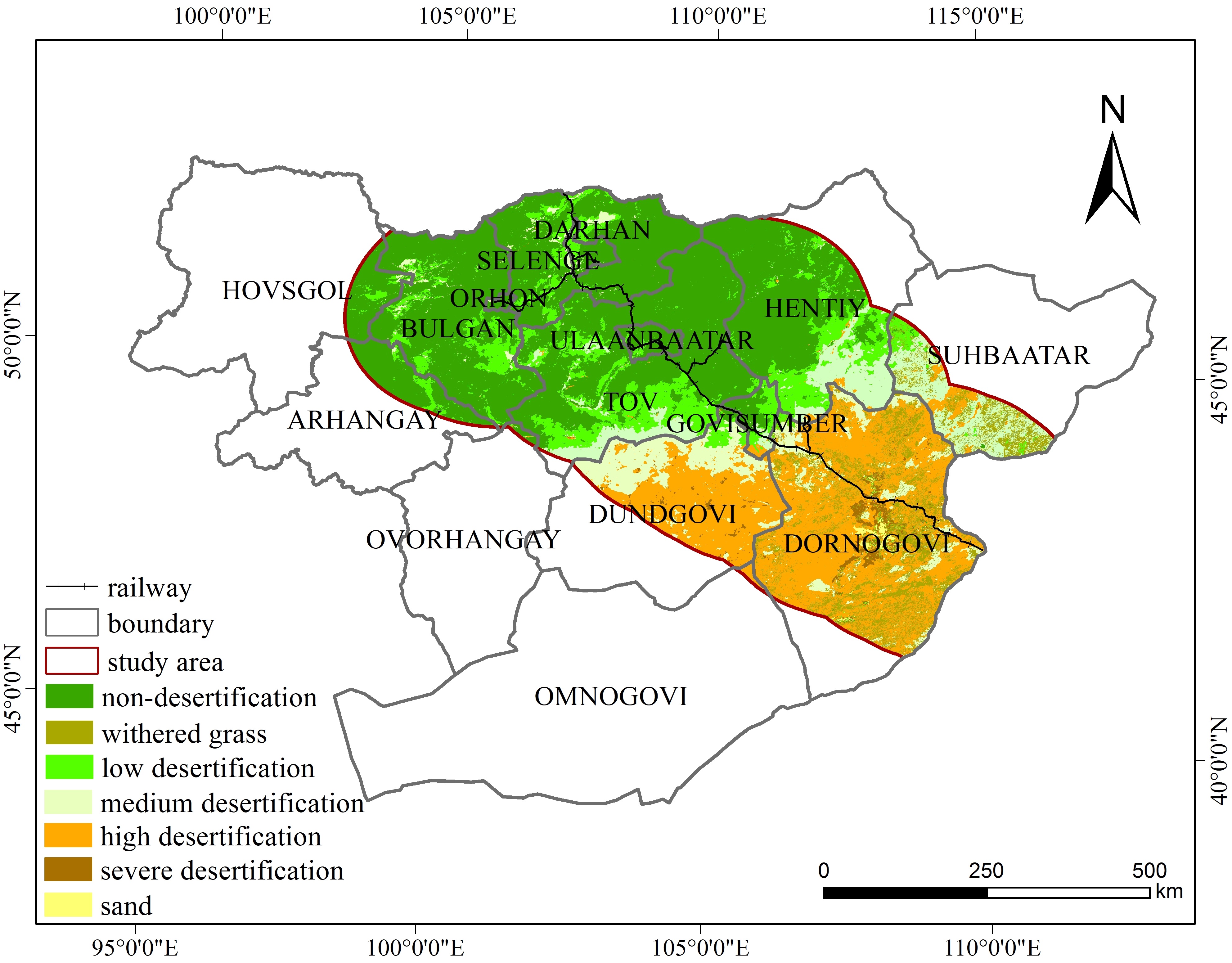
This dataset described the Spatio-temporal Distribution of Desertification Disaster along the China-Mongolia railway (Mongolia section) in 2010, which mainly record the degree of desertification, and spatiotemporal distribution information. They were collected and organized by the Institute of Geographic Sciences and Natural Resources Research, Chinese Academy of Sciences. This dataset was composed of 2 vector files. It can be used in the study of desertification. And it can provide important basis for monitoring and prevention of desertification disaster. Characteristics of temporal and spatial pattern changes.
Comment list ( 0 )

