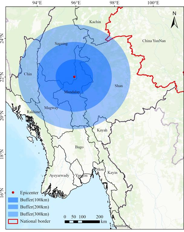
This dataset is presented in Shapefile format. It leverages earthquake center location data supplied by the United States Geological Survey (USGS). The dataset specifically employs this earthquake data to define three distinct buffer zones around each earthquake epicenter. These buffer zones are established at radius of 100 km, 200 km, and 300 km, respectively.
Comment list ( 0 )

