Label : land coverAmur River Basin
Date: 2025-02-19
View counts: 1548
Browse document: Browse document
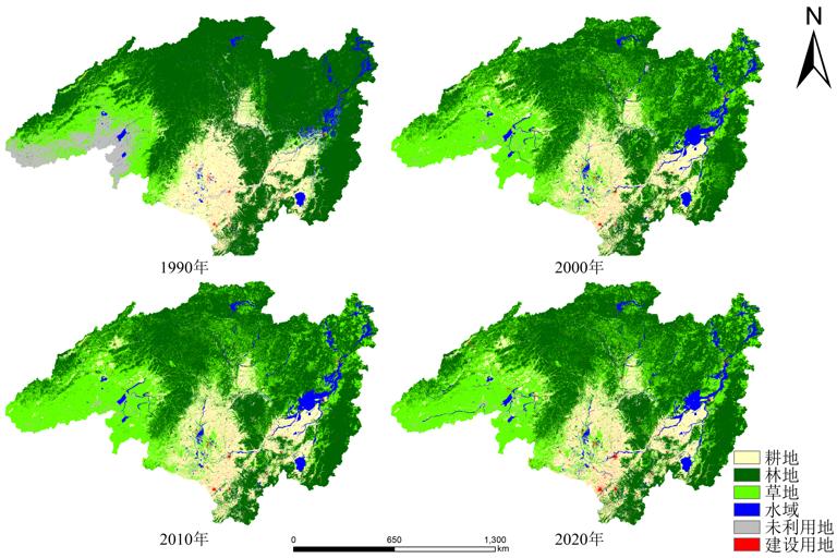
The Amur River Basin is a region with great potential for food production in Northeast Asia, and land cover is one of the important indicators in the study of ecological environment, socio-economic development, and sustainable development, which is of great significance for the development and protection of resources in this region. This dataset is a 30-meter land cover dataset for the Amur River Basin with a time span of 10 years from 1990 to 2020, with four periods. The data are obtained from the GlobeLand 30 and GLC_FCS 30 land cover products by splicing and cropping and other operations to obtain the land cover dataset of Amur River Basin. It provides a data base for the research of regional and local governments, the public, and related scholars, and provides data support for the application of disaster risk assessment, disaster response and prevention, and post-disaster reconstruction in the China-Mongolia-Russia Economic Corridor. The data format is TIFF format, and the spatial resolution is 30 meters.
Comment list ( 0 )

