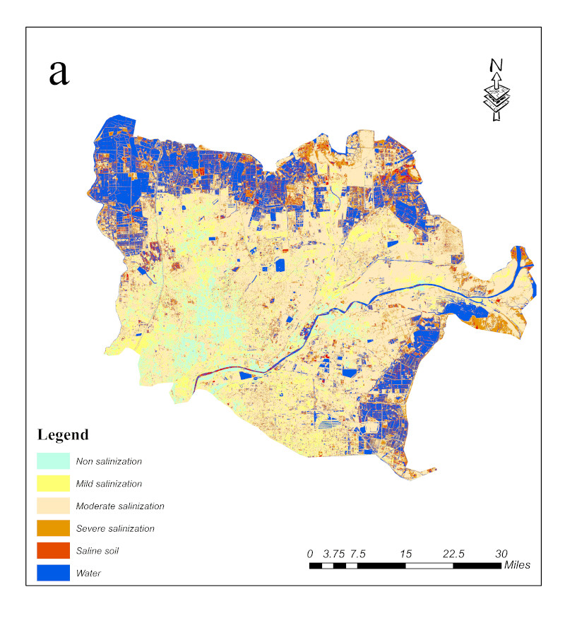
Label : Soil salinizationThe lower Yellow River and coastal cities
Date: 2021-10-22
View counts: 4287
Browse document: Browse document
Download Dataset: Log in
This dataset is a dataset of temporal and spatial changes in salinization in the lower Yellow River and coastal cities from 2015 to 2020. It mainly records the spatial distribution of salinization in the lower reaches of the Yellow River and coastal cities, as well as the characteristics of temporal and spatial distribution. There are 2 vector files in total. They were collected and organized by the Institute of Geographic Sciences and Natural Resources Research, Chinese Academy of Sciences. And it can provide important basis for monitoring and prevention of land degradation disaster.
Comment list ( 0 )

