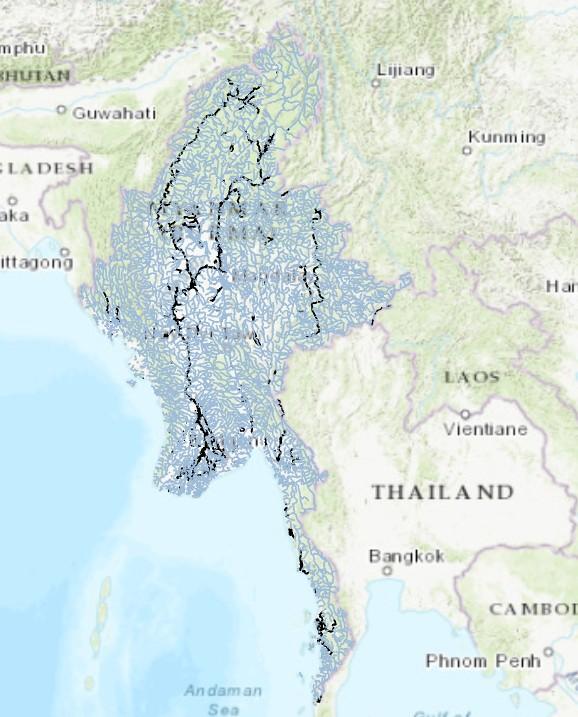
The vector data on the boundaries and areas of river systems in Myanmar provides detailed geographical information on the country's major rivers and their watersheds. These data cover the boundaries and flow directions of major rivers such as the Irrawaddy River, Salween River, Chindwin River, and Sittaung River, as well as their tributaries. Through this vector data, we can clearly see the distribution and watershed ranges of Myanmar's rivers. For example, the watershed area of the Irrawaddy River is approximately 420,900 square kilometers, accounting for 60% of Myanmar's total area, making it the largest river basin in the country. These vector data have significant application value in geographic information systems (GIS), and can be used in various fields such as hydrological analysis, ecological protection, urban planning, and agricultural irrigation, providing a scientific basis for water resource management, environmental protection, and regional development.
Comment list ( 0 )

